EuroGeographics elevates Copernicus Services with geospatial data
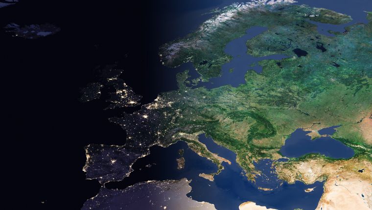
EuroGeographics is drawing attention to the indispensable role of official national geospatial data in enhancing Copernicus Services, particularly within land monitoring and emergency management. This highlights a reinforced partnership between providers of official geospatial data and the European Environment Agency (EEA).
Facilitated by the framework agreement between the EEA and EuroGeographics, representing Europe’s national mapping, cadastral and land registry authorities, the licensing process has been streamlined. This strategic initiative aims to enhance accessibility to authoritative information, thereby supporting the expansion of the Copernicus Reference Data Access (CORDA) database with a wider variety of datasets.
Recently, EuroGeographics has unveiled a series of case studies featuring Albania, Spain, Germany and Iceland. These studies illuminate the invaluable role of official geospatial information in assessing flood and erosion risk, mitigating the impacts of extreme weather events, and advancing the European baseline for monitoring land cover and land use.
Angela Baker, head of partnerships and sustainability at EuroGeographics, said: “The Copernicus Services require reliable and accurate in-situ data to produce and validate their products. The new framework extends our agreement enabling the Copernicus Emergency Mapping Service to use members’ authoritative data to include the Copernicus Land Monitoring Service (CLMS) and the Copernicus Security Service (CSS).” Baker added: “Copernicus Services also have access to administrative boundary data through our agreement with Eurostat, as well as pan-European topographic, gazetteer and imagery datasets and services delivered through the Open Maps for Europe interface and the Open Maps For Europe 2 project (OME2).”
Key services and geospatial data
Jose Miguel Rubio Iglesias, responsible for the Copernicus In Situ component EEA, stated: “To meet end user requirements regarding data content and quality, Copernicus Services need access to open, up-to-date and harmonized geospatial information across Europe. Data produced by the members of EuroGeographics is therefore key to its success.”
"Typically, geospatial data is relevant for all the different services, but we have identified three key services which require geospatial data: the Copernicus Emergency Service and its rapid mapping, and risk and recovery mapping components; the Copernicus Land Monitoring Service; and the Copernicus Security Service which supports, inter alia, the EU External Action Service."
Rubio Iglesias continued: "As one of the Entrusted Entities implementing the Copernicus Land Monitoring Service (CLMS), the EEA is developing the CLC+ Suite of products. Authoritative data from NMCAs is also an important input to the CLC+ Backbone (the geospatial component of the CLC+ Suite of products) to complement the production and updating of satellite-data derived land cover data. By working closely together, we can improve the use of authoritative data and services by Copernicus and ensure national mapping, cadastral and land registration authorities are recognized for their essential contributions."
The case studies focus on: Albania, where detailed elevation data from the State Authority for Geospatial Information (ASIG) aids in assessing flood risk in the Drin river basin; Germany, utilizing digital elevation and land cover data from the Federal Agency for Cartography and Geodesy (BKG) to predict and prevent future flooding; Spain, where data from the National Geographic Institute evaluates the impact of the 2022 Ceuta wildfire and soil erosion risk in forested areas; and Iceland's National Land Survey contributing to European land cover and land use monitoring through various geospatial datasets.
For more information on the case studies, see here.

Value staying current with geomatics?
Stay on the map with our expertly curated newsletters.
We provide educational insights, industry updates, and inspiring stories to help you learn, grow, and reach your full potential in your field. Don't miss out - subscribe today and ensure you're always informed, educated, and inspired.
Choose your newsletter(s)


