Hesai and NavVis innovate reality capture through Lidar sensor collaboration
A new partnership marks a significant milestone in the field of reality capture: NavVis has selected Hesai as its exclusive Lidar sensor provider for its industry-leading device, the NavVis VLX 3, which enables efficient scan-to-BIM workflows. Hesai Technology is a global leader in Lidar sensor solutions, while NavVis is a foremost player in reality capture and digital factory solutions.
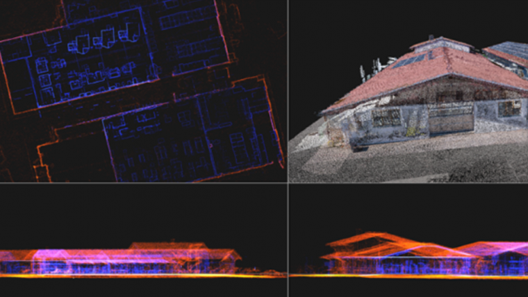
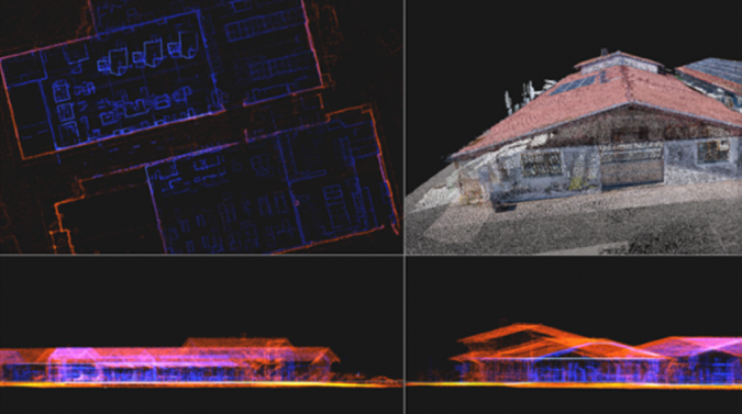
NavVis has gained a stellar reputation for delivering comprehensive and highly detailed reality capture data for digital twin and industrial use cases in manufacturing, especially for factory planning, assembly planning and shopfloor operations. The German company has supported major manufacturing companies like Volkswagen, Siemens and BMW. Its innovative wearable mobile imaging system, NavVis VLX 3, enables laser scanning professionals to efficiently capture and analyse intricate environments, facilitating the accurate and efficient creation of building information models (BIMs).
Highly precise geospatial data capture
The VLX 3 by NavVis will use Hesai's all-new XT32M2X Lidar sensor. By choosing Hesai as Lidar sensor provider, NavVis ensures that its solution benefits from the most advanced and reliable Lidar technology available in the market. Hesai's Lidar sensors offer impressive 120m range performance, accuracy with 32 laser channels, and reliability, empowering NavVis users to capture precise and comprehensive data with extreme efficiency. Based on the joint industry expertise of the two companies, Hesai has designed these Lidar sensors specifically to serve industries such as reality capture, AEC and scan-to-BIM.
"We are thrilled to partner with NavVis, a true leader in the reality capture industry," said Bob in den Bosch, senior vice president of sales, at Hesai Technology. "NavVis has consistently demonstrated a commitment to pushing the boundaries of reality capture technology, and we are proud to be chosen as its Lidar sensor provider. This collaboration allows us to combine our expertise and technological prowess to provide the industry with an unmatched solution that revolutionizes the way complex environments are captured and analysed".
NavVis co-founder and CTO, Georg Schroth, expressed his enthusiasm for the work together, stating: "Hesai Technology has proven to be a true partner in delivering us the exact Lidar sensor that we need to provide survey-grade quality to our customers. By integrating its technology into our mobile mapping system, NavVis VLX 3, we can deliver an even more powerful and efficient solution. This partnership underscores our dedication to providing the highest-quality data and services to our clients, enabling them to make informed decisions based on reality and streamline their scanning workflows."
The collaboration signifies a significant advancement in reality capture, equipping professionals with the capability to survey and analyse complex environments with a groundbreaking level of precision and efficiency.

Value staying current with geomatics?
Stay on the map with our expertly curated newsletters.
We provide educational insights, industry updates, and inspiring stories to help you learn, grow, and reach your full potential in your field. Don't miss out - subscribe today and ensure you're always informed, educated, and inspired.
Choose your newsletter(s)


