Topodrone and Agrowing drive innovation in drone thermal mapping
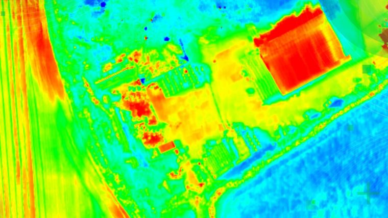
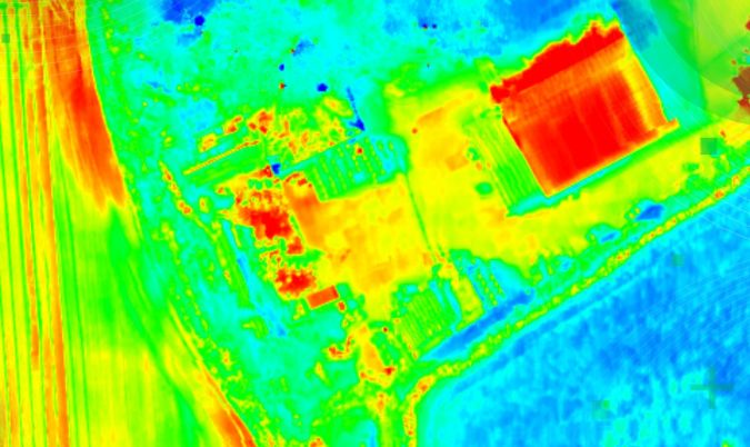
Topodrone has recently unveiled a cutting-edge drone thermal mapping solution: the Topodrone PT61 camera, designed to conduct detailed surveys and generate thermal orthomosaic maps, facilitating the creation of accurate 3D models. Topodrone is a Swiss-based designer and manufacturer of high-precision surveying equipment known for its commitment to research and development.
Initially developed in collaboration with Agrowing at the request of a prominent enterprise client in North America, the photogrammetry solution has since been adapted for broader use by drone surveyors. The PT61 camera boasts a 61MP resolution and includes a built-in thermal imager, RGB lenses with varying focal lengths, a built-in GNSS module and IMU, as well as an API for seamless integration with any UAV. The PT61 camera, when combined with Agrowing’s multispectral lenses, transforms into a dual-purpose RGB/multispectral solution. When equipped with Agrowing’s Quad lens, the camera provides 10 multispectral bands, each with a resolution of 12MP, in addition to the infrared band.
Iliya Shikov, CTO of Topodrone, remarks: "This year, we observe an increased demand from surveyors for solutions related to renewable energy. Combining thermal and Lidar data can definitely provide deeper insights, particularly in solar plant inspections and dam management."
Ira Dvir, CEO of Agrowing, expresses enthusiasm about the collaboration, stating: "Agrowing has been partnering with Topodrone for a few years, providing cutting-edge photogrammetry technologies. We welcome Topodrone’s new thermal mapping solution, marking a significant step forward in the race to provide valuable data-driven insights into urban mapping, energy efficiency and disaster response."
Topodrone's post-processing software has been upgraded to enhance remote sensing efficiencies, ensuring the delivery of high-precision thermal orthomosaic maps.

Value staying current with geomatics?
Stay on the map with our expertly curated newsletters.
We provide educational insights, industry updates, and inspiring stories to help you learn, grow, and reach your full potential in your field. Don't miss out - subscribe today and ensure you're always informed, educated, and inspired.
Choose your newsletter(s)


