Inspire the younger generation!
Two initiatives aimed at encouraging young individuals to pursue a career in mapping and surveying are highlighted by Wim van Wegen in this column. He hopes that they will trigger other...

Two initiatives aimed at encouraging young individuals to pursue a career in mapping and surveying are highlighted by Wim van Wegen in this column. He hopes that they will trigger other...
The Open Maps For Europe 2 (OME2) project has revealed plans to boost the utilization of European cadastral data. This includes efforts to enhance its discoverability and accessibility. As part...

Visitor registration is now open for GEO Business, the UK's largest geospatial event. The free-to-attend expo, tailored for geospatial professionals seeking to harness the potential of location intelligence, will return...
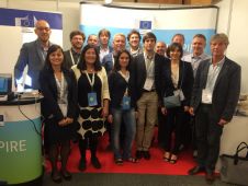
The INSPIRE team is participating at the INSPIRE Conference 2017 “INSPIRE a digital Europe: Thinking out of the box” in Kehl/Strasbourg from 4th - 8th September 2017. In Kehl, on...
Safe Software has completed a prototype spatial data transformation solution that supports the requirements of the European Union's INSPIRE Directive. In conjunction with Metria AO Cadastre of Sweden, the FME-based...
INSPIRE is about efficiently sharing digital spatial data related to the environment between public authorities at all levels of government, across borders and with the public at large. Such requires...
The Open Geospatial Consortium (OGC, USA) and EuroGeographics, France, have signed a memorandum of understanding (MOU) to promote interoperability through open standards to benefit the European geospatial community. The two...
Metadata about Ordnance Survey’s products have been made available through data.gov.uk, alongside INSPIRE-compliant view services through the OS OnDemand web map service. The INSPIRE Directive establishes a framework for easier sharing...
Esri has released ArcGIS for INSPIRE, a product developed to meet the data, services, and metadata requirements of the European Union-mandated Infrastructure for Spatial Information in Europe (INSPIRE). Organisations can...
The Head Office of Geodesy and Cartography in Poland (GUGiK) is implementing an Esri-based solution to support compliance with the European Union’s Infrastructure for Spatial Information in Europe (INSPIRE) Directive....
This site uses cookies. By continuing to use this website, you agree to our Cookies Policy. Agree