Satellite maps of Haiti Earthquake
Satellite images of the Port-au-Prince districts, damaged as a result of the 12th January earthquake, are in free access. Maps have been prepared by SCANEX specialists based on the GeoEye-1...
Satellite images of the Port-au-Prince districts, damaged as a result of the 12th January earthquake, are in free access. Maps have been prepared by SCANEX specialists based on the GeoEye-1...
The expiring year witnessed the installation of the Alice-SC satellite data receiving and processing station at the Voyeikov Main Geophysical Observatory in St-Petersburg (Russia). The station has been developed and...

ScanEx Research and Development Center and the «Kazakh Agency of Applied Ecology» (KAPE) initiated the second stage of satellite-based radar monitoring of the northern and middle part of Caspian Sea....
The latest Geostationary Operational Environmental Satellite, GOES-O, soared into space after a successful launch from Space Launch Complex 37 at the Cape Canaveral Air Force Station in Florida on Sunday...
Having rewarded Europe's best ideas for innovative satellite navigation applications technology, the European Satellite Navigation Competition (ESNC) is now in its 6th year. GRACE is holding a workshop on 1st...

GeoEye has successfully launched GeoEye-1, the world's highest resolution, commercial Earth-imaging satellite. GeoEye's ground station in Norway relayed the downlink signal it received rom GeoEye-1 confirming that the satellite successfully...

A Chinese CZ-4C Chang Zheng-4C launch vehicle - carrying the Feng Yun-3A satellite - has lifted off from the Taiyuan Satellite Launch Center located in the Shanxi province. The first...

A further step towards the deployment of Europe's Galileo global navigation satellite system has been taken, with the successful launch of ESA's second Galileo In-Orbit Validation Element (GIOVE-B) satellite, carrying...
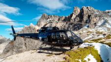
Gravitational acceleration measurements were conducted in the Allgäu region of southern Germany by the Federal Agency for Cartography and Geodesy (BKG) in September this year. In high-altitude locations, helicopters were...
This site uses cookies. By continuing to use this website, you agree to our Cookies Policy. Agree