Stratospheric Network Forecast
Unmanned Aerial Vehicles (UAVs) flying for months or years above the Jet Stream will form a new communication and sensing infrastructure. National security payloads will emphasise sensors like cameras or...
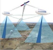
Unmanned Aerial Vehicles (UAVs) flying for months or years above the Jet Stream will form a new communication and sensing infrastructure. National security payloads will emphasise sensors like cameras or...
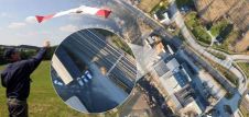
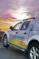
Since 2009 Blom Germany have been working with SmartPlanes to develop a cost-effective light-weight UAV solution for the European market. With more than a hundred trials and now some ten...
Leica Geosystems, Switzerland, has released the Leica RCD30, the first metric medium-format 60MP camera to acquire co-registered multispectral four-band imagery in RGB and NIR for photogrammetric and remote sensing mapping...
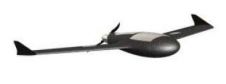
Couderé Geomatic Engineering, Belgium, and Gatewing have entered into an agreement which allows Couderé to market and support Gatewing's X100 unmanned aerial vehicle in Belgium, The Netherlands, Luxembourg, Germany, Switzerland...
Trimble has, at Photogrammetric Week, presented its 80 megapixel Trimble Aerial Camera (TAC 80MP), extending the range of applications for today's medium-format aerial cameras. With advanced features such as Trimble's...
Everyone who truly matters in the geomatics and surveying-related business will be travelling to Germany – or more precisely to the Bavarian city of Nuremberg – in the last week...
Everyone who truly matters in the geomatics and surveying-related business will be travelling to Germany ¨C or more precisely to the Bavarian city of Nuremberg ¨C in the last week...

The first day of Intergeo on 27th September 2011 has shown many new developments in the world of geomatics. UAVs obviously is one of the hot topics this year, compared...
Pythagoras BV has been developing software solutions for the geospatial industry for more than 30 years. We strive to deliver CAD & GIS solutions for all your mapping projects. Together...
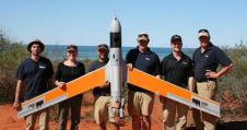
Insitu Pacific, Australia, has concluded the second phase of a trial conducted in partnership with Murdoch University that aims to determine whether unmanned aircraft systems (UAS) are a cost-effective, capable...
This site uses cookies. By continuing to use this website, you agree to our Cookies Policy. Agree