Building a digital twin for Germany
The German Federal Agency for Cartography and Geodesy (BKG) is creating a digital twin of the whole of Germany that can be used to simulate various future scenarios in order...

The German Federal Agency for Cartography and Geodesy (BKG) is creating a digital twin of the whole of Germany that can be used to simulate various future scenarios in order...

The European Environment Agency (EEA) recently awarded a contract to implement the new High-Resolution Layer (HRL) Vegetated Land Cover Characteristics (VLCC), as part of the pan-European Copernicus Land Monitoring Service...

SingularXYZ focuses on high precision GNSS PNT (Positioning, Navigation and Timing) technology, extending its coverage to horizontal and vertical industries. This mainly includes geospatial information, precision agriculture, machine control, robotics,...

The coming years look promising for the geomatics sector, but the new generation of professionals must be prepared to face the challenges ahead. In view of the looming labour shortage...
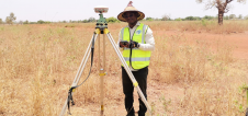
By applying Beidou technology, ComNav Technology has yielded fruitful results in African land mapping, continuous operating reference station (CORS) construction, precision agriculture and other fields over the past decade. Every...
Phase One has announced its new iX Suite, a fully integrated software package for aerial mapping project management. Compatible with all Phase One PAS airborne systems, iX Suite handles mission...

YellowScan has announced the addition of Beijing-based EcoTech to its global partner network. Specializing in spectral imaging technology, EcoTech is dedicated to the promotion, research and development of ecology-agriculture health...

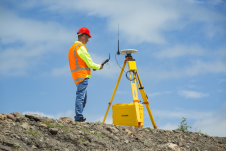
Topcon Positioning Group designs, manufactures and distributes precision measurement and workflow solutions for the global construction, geospatial and agriculture markets. Since it was founded in 1994, Topcon has worked to...
Trimble has introduced the R750 modular GNSS receiver, a connected base station for use in civil construction, geospatial and agricultural applications. The R750 provides improved base station performance, giving contractors,...

Trimble and Microsoft have announced a strategic partnership to advance technology adoption and accelerate the digital transformation of the construction, agriculture and transportation industries. By leveraging the Microsoft cloud, Trimble...
This site uses cookies. By continuing to use this website, you agree to our Cookies Policy. Agree