The First-ever Online-only UN-GGIM Session
The United Nations Committee of Experts on Global Geospatial Information Management (UN-GGIM) gathered for its Tenth Session in the shape of three two-hour informal meetings on 26 and 27 August...

The United Nations Committee of Experts on Global Geospatial Information Management (UN-GGIM) gathered for its Tenth Session in the shape of three two-hour informal meetings on 26 and 27 August...

Hexagon's Geosystems division is to provide a homogeneous, comprehensive digital surface model (DSM) for Germany under a contract awarded by the German Federal Agency for Cartography and Geodesy (BKG). The...

GAF AG has won an international tendering process issued by the German Federal Agency for Cartography and Geodesy (BKG) for the provision of remote sensing data. The framework agreement includes...

From 13 to 15 October, the virtual doors to Intergeo 2020 will be open on www.intergeo.digital. This year, all the familiar ingredients of the annual Intergeo event will be available...

The Spanish high-resolution land imaging mission, known as SEOSAT-Ingenio, will soon be shipped from Airbus in Madrid to Europe’s Spaceport in French Guiana, where it will be prepared for launch...

Crazy about history? Crazy about history? Join us in an Afternoon of History… This year, The FIG Permanent Institution of History of Surveying joint forces with De Hollandse Circle to...
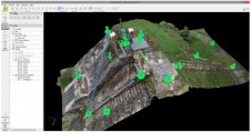
The skills that engineering surveyors had to acquire in order to respond to the challenges of the construction world have made them capable, also, of fulfilling other challenges, several of...
The focus of FIG Commission 2 is on innovative and effective professional education and training for surveyors. This involves curriculum development, innovations in teaching and learning, life-long learning, attracting new...

Commission 1 focuses on establishing a set of ethical principles that fits the surveying profession for reference by professional institutions. It also focuses on promoting greater understanding and improving community...

The European Union (EU) is adding a new dimension to the digital data-distribution policies of mapping agencies, cadastres and land registries. In two years’ time, a new EU directive will...
This site uses cookies. By continuing to use this website, you agree to our Cookies Policy. Agree