Vasily Lukashov
Vasily Lukashov is the founder & CEO of FIXAR. He is an engineer, developer and innovator of unmanned aerial solutions with deep roots in the industry since a young age....

Vasily Lukashov is the founder & CEO of FIXAR. He is an engineer, developer and innovator of unmanned aerial solutions with deep roots in the industry since a young age....

The aerial survey system for upgrading digital maps of Qatar has become operational. Under the aerial surveys project for Qatar, the mission of aerial photography covering all parts of the...
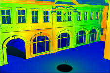
The VRscan3D project has developed a virtual terrestrial laser scanner simulator as a training tool to support the learning of laser scanning processes. It is intended for use by universities...
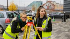
The coming years look promising for the geomatics sector, but the new generation of professionals must be prepared to face the challenges ahead. In view of the looming labour shortage...
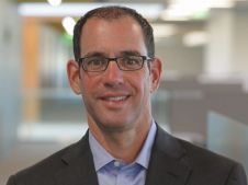
In this interview, Ron Bisio, senior vice president of Trimble Geospatial, provides his views on the key market trends, technology drivers and challenges, and the impacts of COVID-19 and climate...
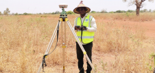
By applying Beidou technology, ComNav Technology has yielded fruitful results in African land mapping, continuous operating reference station (CORS) construction, precision agriculture and other fields over the past decade. Every...
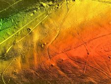
A high-precision terrain mapping project has revealed more than 400 ‘new’ archaeological sites in England’s first Area of Outstanding Natural Beauty (AONB). Commissioned by the Quantock Landscape Partnership Scheme (QLPS)...

Powerhouses of photogrammetry and remote sensing science and industry are set to gather in Nice, France, for the XXIV Congress of the International Society for Photogrammetry and Remote Sensing (ISPRS) from 6-11 June 2022. Powerhouses of photogrammetry and remote sensing science and industry are set to gather in Nice, France, for the XXIV Congress of the International Society for Photogrammetry and Remote Sensing (ISPRS)...
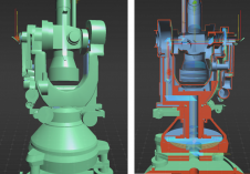
A recent project has celebrated 100 years of geodetic and photogrammetric innovation by 3D-digitizing an iconic WILD T2 theodolite from the 1927 series. An app has also been developed for...

Prof Greg Foliente is professor of the University of Melbourne’s Faculty of Engineering and Information Technology and deputy director of the Centre for Disaster Management and Public Safety. He leads...
This site uses cookies. By continuing to use this website, you agree to our Cookies Policy. Agree