Point-cloud Preservation Plans
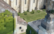
The first step in the preservation of monuments and historic buildings is to completely survey and map the target; this is followed by digitised documentation for future research, reference or...

The first step in the preservation of monuments and historic buildings is to completely survey and map the target; this is followed by digitised documentation for future research, reference or...
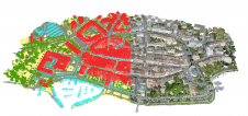
The Open Maps For Europe 2 (OME2) project has revealed plans to boost the utilization of European cadastral data. This includes efforts to enhance its discoverability and accessibility. As part...
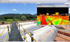
Leica Geosystems announces the exclusive distribution of RealityLINx Model 5.4 - powered by Leica point cloud Engine (pcE) technology. RealityLINx Model 5.4 speeds and simplifies the processing of as-built laser...
Leica CloudWorx-VR for 3ds Max, 3ds Max design, and Maya are plug-ins providing a convenient way for professionals to efficiently create more photorealistic and compelling models, renderings, and animations based...
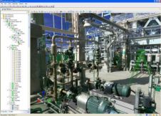
Leica Geosystems announces major releases of its flagship point cloud software applications: Cyclone 6.0; CloudWorx 4.0; and TruView 2.0. All applications now include intuitive, panoramic viewing of point clouds plus...
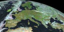
Land Information New Zealand has made 20TB of aerial imagery available for free for the first time in a cloud-optimized format on Amazon Web Services (AWS), making it easier and...
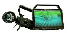
Exyn Technologies has unveiled Exyn Nexys, an innovative modular 3D mapping solution. Designed for professionals in the mining, construction, AEC and geospatial industries, Nexys aims to set a new standard...
Read this guide to the main 3D data representation methods to understand the key differences and choose the best method for your specific applications. The 3D data jungle in today’s...
Pix4Dmapper is an industrial-standard photogrammetry software package that provides accurate 3D reconstruction from overlapping images. Along with the expanding drone market, people are keen to explore new solutions to replace...
To be useful, the millions or even billions of 3D points generated by a variety of active and passive sensors need to be stored, organised, combined, georeferenced, measured and analysed,...
This site uses cookies. By continuing to use this website, you agree to our Cookies Policy. Agree