Commercial UAV EXPO
Commercial UAV Expo, presented by Commercial UAV News, is the leading international trade show and conference focusing on the integration and operation of commercial UAS in select vertical markets. 206...

Commercial UAV Expo, presented by Commercial UAV News, is the leading international trade show and conference focusing on the integration and operation of commercial UAS in select vertical markets. 206...
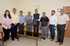
Trimble has announced a collaboration with the Indian Institute of Technology in Kanpur (IIT Kanpur) to support a new UAV programme offered by the Department of Aerospace Engineering. Trimble's contribution...
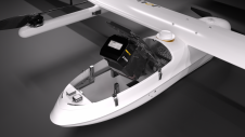
JOUAV has released the JoLiDAR-1000 Lidar sensor designed specifically for uncrewed aerial vehicles (UAVs or ‘drones’) as the latest addition to its array of high-performance Lidar sensors for use in...
Mosaic has partnered with Movella aimed at redefining precision and efficiency in mapping and 3D reconstruction projects. Mosaic is specialized in mobile mapping camera systems, while Movella is a renowned...

Visitor registration is now open for GEO Business, the UK's largest geospatial event. The free-to-attend expo, tailored for geospatial professionals seeking to harness the potential of location intelligence, will return...
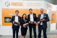
RIEGL has recently added the VUX-18024, a lightweight and versatile UAV-Lidar sensor for high-speed surveying missions, to its portfolio. This once again underlines the Austrian company’s pioneering role as a...

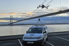
Accurate bathymetric mapping of shallow areas is essential for many offshore activities. Through Structure from Motion (SfM) and Multiview Stereo (MVS) techniques, images can provide a low-cost alternative compared to Lidar...
DJI selected Intergeo in Berlin as the stage for unveiling the DJI Zenmuse L2. This highly integrated Lidar system builds on the success of DJI’s Zenmuse L1 to bring new...
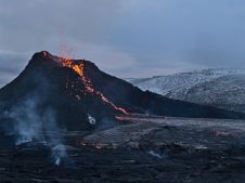
The Icelandic authorities have commissioned Acecore to map the extent and aftermath of the Eldvörp-Svartsengi volcanic system eruption using its high-end drone solutions. Grindavík, a fishing village on the Reykjanes...
PlanetScope is now accessible on Google Cloud Marketplace. This availability of Planet's flagship satellite imaging product contributes to the company's mission to democratize access to near-daily satellite imagery, enabling organizations...
This site uses cookies. By continuing to use this website, you agree to our Cookies Policy. Agree