Linking GIS and the Cloud
The recent news that the US federal government is looking to purchase cloud-based services with an estimated value of USD2.5 billion should be enough evidence to change the mind of...
The recent news that the US federal government is looking to purchase cloud-based services with an estimated value of USD2.5 billion should be enough evidence to change the mind of...

An ash cloud from the Islandic volcano Eyjafjallajokull blocks the air traffic in parts of the UK and northern Europe. The UK Met Office has made available methods used for...
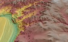
The Point Cloud CAD 2010 is Microsurvey's latest product that allows the individual to work with Point Cloud and LIDAR data with ease. MicroSurvey has spent the last year working...

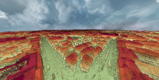
Point clouds are increasingly beginning to prove their worth in the construction industry, but the ability to work with point clouds within AutoCAD has been limited. Pointools Model makes it...

FARO recently announced a new update of SCENE WebShare Cloud, representing a substantial leap forward in worldwide secure 3D reality data exchange, collaborative project management and high-efficiency scan-to-BIM operations among...
Virtualgeo was established in 1994 as a spin-off from an established survey company active in the field of topographic survey and infrastructure planning since 1985. Virtualgeo has three offices in...
A dense annotated ground-truth Lidar dataset of the city of Dublin is the first of its kind regarding the accuracy, density and diversity of classes. The hierarchical labels offer excellent...

3D Target has continued to make significant advancements since launching its inaugural Scanfly model at Intergeo in 2016, at a time when Lidar technology in the UAV industry was still...

Aerial surveying offers diverse career opportunities. How are trends in the evolving landscape of geomatics studies affecting graduates' skills, and what could this mean for the future of the industry?...
Virtual Surveyor has enhanced the Lidar elevation data handling capabilities in version 6.4 of its drone surveying and mapping software. The function enables users to select specific feature classes from...
This site uses cookies. By continuing to use this website, you agree to our Cookies Policy. Agree