Trimble Mobile Mapping Solutions
Take control of the way you work. Scanning, imaging, processing, and sharing at speed and scale. Trimble Mobile Mapping technology unlocks the next generation of geospatial projects. Learn More→

Take control of the way you work. Scanning, imaging, processing, and sharing at speed and scale. Trimble Mobile Mapping technology unlocks the next generation of geospatial projects. Learn More→

Leica Geosystems, part of Hexagon, has introduced the Leica Pegasus TRK100 as the latest addition to its portfolio of mobile mapping solutions. Specifically designed for GIS professionals, the new mobile...
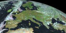
The Open Maps For Europe 2 (OME2) project has revealed plans to boost the utilization of European cadastral data. This includes efforts to enhance its discoverability and accessibility. As part...

GrabMaps is preparing to launch KartaCam 2, a crowdsourced mapping solution combining high-end imagery and AI capabilities to transform local expertise into effective navigation solutions. With the introduction of enhanced...
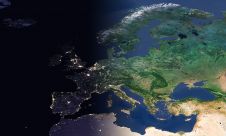
EuroGeographics is drawing attention to the indispensable role of official national geospatial data in enhancing Copernicus Services, particularly within land monitoring and emergency management. This highlights a reinforced partnership between...

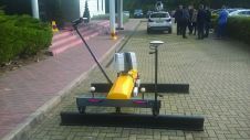
RIEGL has announced the launch of two innovative topobathymetric scanners. These advancements mark a shift towards enhanced efficiency and precision in data collection across land and water interfaces. The RIEGL...
Leica Geosystems mobile mapping day featured the UK release of two new pieces of equipment and a refresh of two others. The day at Milton Keynes was a mix of...
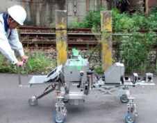
Common mobile mapping systems heavily rely on positioning using GNSS. However, concrete, soil and other materials block GNSS signals, thus impeding their use when inspecting pipelines, subways or other underground...
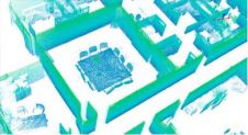
Trimble's Indoor Mobile Mapping System (TIMMS) is a manually operated push-cart designed to accurately model interior spaces without accessing GPS. It consists of 3 core elements: Lidar and camera systems...
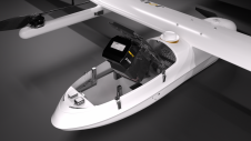
JOUAV has released the JoLiDAR-1000 Lidar sensor designed specifically for uncrewed aerial vehicles (UAVs or ‘drones’) as the latest addition to its array of high-performance Lidar sensors for use in...
This site uses cookies. By continuing to use this website, you agree to our Cookies Policy. Agree