AI-powered climate resilience
The use of AI in monitoring and modelling climate conditions is bringing about a revolution, especially in the field of geospatial data collection and mapping. With the help of AI-powered...
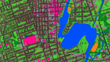
The use of AI in monitoring and modelling climate conditions is bringing about a revolution, especially in the field of geospatial data collection and mapping. With the help of AI-powered...

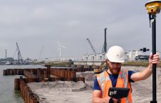
At OxTS, in line with our brand promise of being inertial navigation experts, our commitment to our customers is that we will keep innovating until we can help them truly ‘navigate anywhere’ – with or without GNSS. We are advancing our products in that direction by first enhancing urban navigation data quality based on sensor fusion. Here, we explain how. At OxTS, in line with our brand promise of being inertial navigation experts, our commitment to our customers is that we will keep innovating until we can help them truly...

Dr Lingli Zhu received her doctoral and master’s degrees in the field of Remote Sensing and Photogrammetry from Aalto University in 2015 and 2007, respectively. Currently, she is leading an...
In line with tradition, we have conducted the latest annual 'GIM International' survey among our readership of geospatial professionals to identify key trends, developments and challenges related to technology and business...
Bluesky Geospatial has announced the launch of its MetroVista 3D aerial mapping programme in the USA. The service employs a hybrid imaging-Lidar airborne sensor to capture highly detailed 3D data,...
Golden Software's Surfer has been enhanced with subsurface visualization and modelling capabilities. The latest release of this well-known surface mapping software features several true 3D gridding and visualization tools. The...
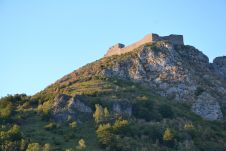
The city of Carcassonne in the south of France hopes to obtain UNESCO World Heritage certification for its sentinel mountain castles, better known as Les Châteaux Cathares. Built in the...
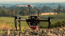
‘Smart agriculture’, i.e. the efficient use of Earth's resources to feed the world, requires accurate and advanced data acquisition, modelling and management. UAVs can play a critical role in this....
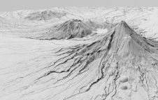
A new, high-tech aerial laser survey project has been completed in the New Zealand region of Taranaki, producing an exact 3D map of the region's land surface. The survey, conducted...
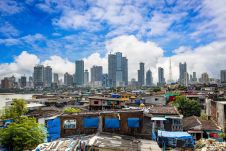
This article explores how some government initiatives in India are utilizing geospatial technologies for better outcomes. The rapid pace of urbanization in India has been an instrument of socioeconomic, political...
This site uses cookies. By continuing to use this website, you agree to our Cookies Policy. Agree