The invigorating geospatial vibes in Vegas
In the rapidly evolving landscape of geospatial technology, the annual Trimble Dimensions gathering is a dependable beacon for the surveying and mapping fields, providing a panoramic view of the current...
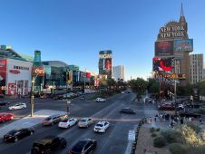
In the rapidly evolving landscape of geospatial technology, the annual Trimble Dimensions gathering is a dependable beacon for the surveying and mapping fields, providing a panoramic view of the current...

In a groundbreaking collaboration, Genesys International and Survey of India (SOI) have formed a strategic alliance to create digital twins of major cities and towns. This partnership is aimed at...

Intergeo 2023 was an electrifying three-day event in Berlin, transforming the city into the global geospatial capital. From 10-12 October, professionals from across the globe convened for the world’s premier...
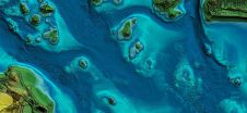
In this article, we examine the evolving landscape of bathymetry with insights from Anders Ekelund, vice president of airborne bathymetric Lidar at Hexagon Geosystems. Beyond mapping seagrass, Ekelund unveils Lidar’s...
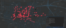
How can city digital twins support the attainment of SDG11? They can be used to manage infrastructures (e.g. roads, transportation and public services, smarter energy grids and water networks), support...
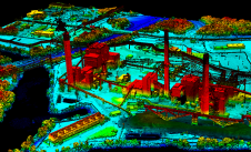
Woolpert has forged a strategic alliance with Allvision with the goal of enhancing geospatial artificial intelligence capabilities and applications. This partnership seamlessly integrates Pittsburgh-based geospatial analytics and asset management company...

The organizers of Geo Week have released a preview of two keynote sessions for 2024: 'The Bright Future Ahead: Navigating AEC, 3D, and Geospatial Innovation and Change', and 'Geospatial for...
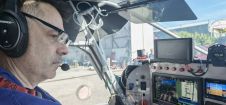
Aerial surveying offers diverse career opportunities. How are trends in the evolving landscape of geomatics studies affecting graduates' skills, and what could this mean for the future of the industry?...
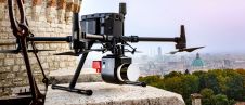
3D Target has continued to make significant advancements since launching its inaugural Scanfly model at Intergeo in 2016, at a time when Lidar technology in the UAV industry was still...
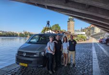
Prague recently served as the testing ground for the integration of Mosaic’s 360-degree camera system with SmartDelta’s mobile mapping software. Known for its rich history and stunning architecture, the city...
This site uses cookies. By continuing to use this website, you agree to our Cookies Policy. Agree