ROCK Robotic introduces new Lidar mapping systems
ROCK Robotic has announced the launch of its latest Lidar mapping system, the R3 and R3 PRO. The R3 product line introduces advanced hardware components into a lightweight, integrated 3D...
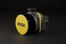
ROCK Robotic has announced the launch of its latest Lidar mapping system, the R3 and R3 PRO. The R3 product line introduces advanced hardware components into a lightweight, integrated 3D...
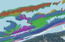
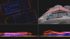
This article presents a novel methodological approach to understand and assess the suitability of airborne Lidar bathymetry for the automatic classification and mapping of the seabed. This solution allows recording of...
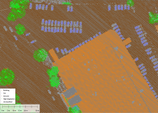
Blue Marble Geographic’s flagship software, Global Mapper Pro, is an all-in-one GIS package for analysing and processing vector, terrain, image and point cloud data. Compatible with over 380 different file...
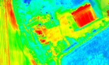
Topodrone has recently unveiled a cutting-edge drone thermal mapping solution: the Topodrone PT61 camera, designed to conduct detailed surveys and generate thermal orthomosaic maps, facilitating the creation of accurate 3D...
A new partnership marks a significant milestone in the field of reality capture: NavVis has selected Hesai as its exclusive Lidar sensor provider for its industry-leading device, the NavVis VLX...
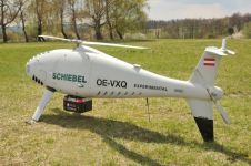
RIEGL Laser Measurement Systems and Schiebel have successfully completed the integration of a high-end laser scanning system, the RIEGL VQ-840-G topobathymetric Lidar sensor, on the Schiebel Camcopter S-100 uncrewed aerial...
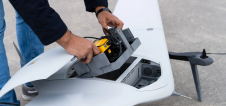
Dutch drone manufacturer DeltaQuad has integrated a colourized Lidar solution into its latest Evo UAV in partnership with YellowScan, a manufacturer of Lidar mapping solutions. The DeltaQuad Evo is the...

Arkadiusz Szadkowski is senior business development manager of reality mapping, imagery & remote sensing at Esri. He is passionate about leading the change towards 3D GIS and bridging the gap...
It can still be difficult to achieve centimetre-level accuracy in mobile mapping, especially in GNSS-denied or challenging areas such as in deep urban canyons, under foliage or through tunnels. However,...

In a high-flying endeavour spanning over six decades, the UK’s National Grid's fleet of advanced helicopters have been diligently patrolling pylons and power lines, ensuring the health and reliability of...
This site uses cookies. By continuing to use this website, you agree to our Cookies Policy. Agree